Permanent Trim Course
CNYO maintains a permanent orienteering course at Pratt’s Falls County Park in Pompey, New York. This beautiful Onondaga County park offers scouts, youth groups, and the general public the opportunity to practice map and compass skills amidst scenic waterfalls and verdant woods. It’s a great training venue for scouts in anticipation of our annual Scout-O event at Highland Forest. The course is free and open to the public during regular park hours. Please note that the park is closed November-March.
Several times a year the club hosts open house events at the park, where we hand out free maps, lend compasses, answer questions, and help you get started.
What do I need?
To complete the course, you will need:
- A detailed orienteering course map (newly updated for summer 2025)
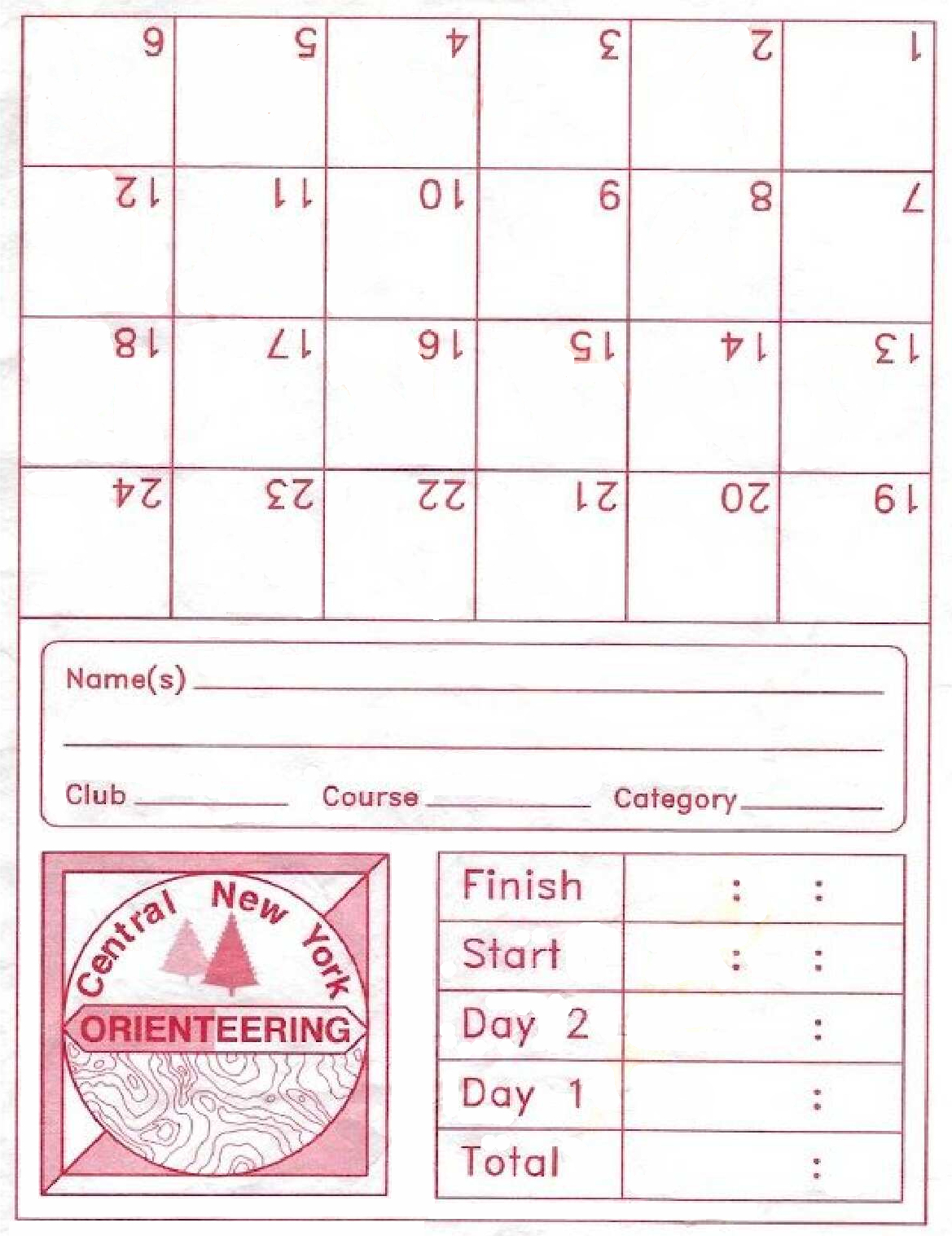
- A punch card
- A pen, pencil, or crayon
Download the map and the punch card from the links below. Print them out, and bring them with you. To protect them from the elements, place them in a page protector or gallon-sized plastic bag.
If you’ve never orienteered before, we suggest that you start with the easiest course first. It is possible to find the easiest points without a compass, but for points off-trail, we recommend that you bring a decent quality compass and be familiar with its use. Learning resources are available online.
How does the course work?
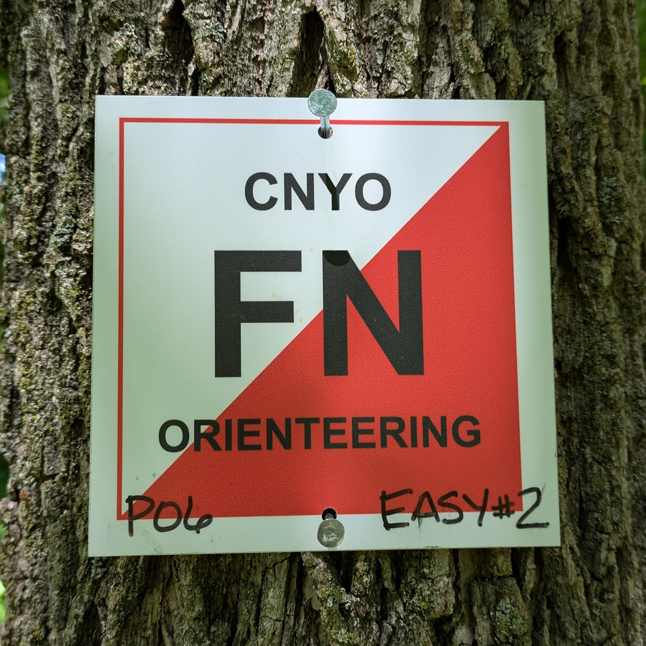 Our orienteering course uses 6″ square metal markers permanently placed on trees and other features at the park. The master course map shows the location of 25 of these control points sorted into three different levels of difficulty. The 8 beginner points are all within a half mile walk of the main parking lot and are located along trails and prominent features. The 8 intermediate points are off trail and a bit more challenging, but still an easy walk from the parking lot. The 9 advanced points will take you further afield and require some proficiency with a map and compass to find. Use the clue descriptions on the map to give you more information about the specific location of each point.
The control point difficulty is as follows:
- Short and easy points: 4, 6, 7, 10, 18, 19, 22, 23 on the master map
- Intermediate points: 8, 9, 11, 12, 13, 15, 16, 17 on the master map
- Advanced points: 1, 2, 3, 5, 14, 20, 21, 24 on the master map
NEW THIS YEAR! — The master map shows the locations of all 25 of the control markers. You may use this map to challenge yourself to find the control markers in any order (planning a route is part of the fun) and you don’t need to limit yourself to just one skill level. But if you want to visit just the easiest points in a nice logical order, download the “Short and Easy” course map which shows only the easiest eight points. Looking for more of a challenge? Download the “Intermediate” course map with eight points of the next level of difficulty. And for those that are looking for a strenuous day in the woods, download the “Advanced” course map with hardest nine points. Links to all of the maps are at the bottom of this page.
Each control marker has a two-letter code printed on it. When you find a marker, write the code in the corresponding box on the punch card. Find them at your own pace and make multiple park visits if needed. When you have completed your adventure, you can scan your card or copy the information into an email and send it to our course steward for verification.
Stuck? If you can’t find a control, look at the surrounding area to be sure the land matches the map. Then double check the clue description to be sure you are looking for the right features. The more you practice, the more successful you will become. If a control marker is damaged or missing please report it to course steward, who can also answer other questions regarding the course.
Where is our course located?
Pratt’s Falls County Park
7671 Pratts Falls Road
Manlius, NY 13104
(between Henneberry Road and Watervale Road)
Safety Rules
- Always let someone know where you are going and when you expect to return. If you are a beginner, we recommend that you go with a friend(s).
- Bring a whistle. Three long blasts means “Help!”
- Safety bearing is SOUTH. If you become lost, you can travel due South to the Pratt’s Falls Road. The park is not huge, so you should never be more than 1/3 mile from a road or trail.
- Always check back in with whomever you told your plans to. Otherwise you may be the object of an unnecessary search.
Downloading the map serves as agreement to a waiver in which you fully accept all risks and responsibilities for losses, costs and damages you incur as a result of your participation in this event, and that you release the Central New York Orienteering Club, New York State and OUSA from any liability. A copy of the waiver is posted here.
Downloadable Files
Master Map | Short and Easy Map | Intermediate Map | Advanced Map | Punch Card | Control Descriptions | Map Symbols